-
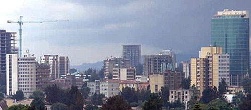
Addis Ababa,
Historic City Tour, Menilik Museum, Trinity Cathedral, St. George and Entoto Mountain
-
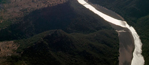
Blue Nile Gorge
226 KM from Addis Ababa, Portuguese Bridge
-
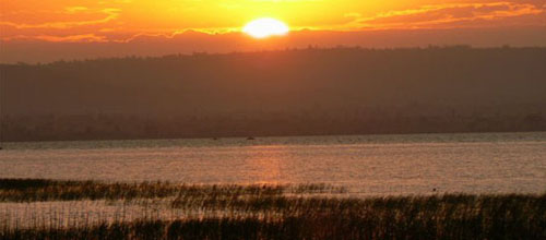
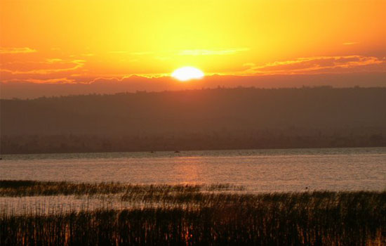
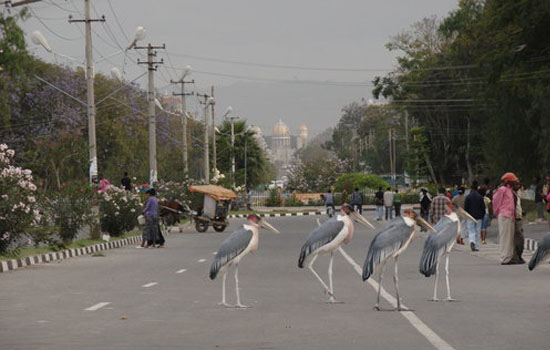
Hawassa
275 km from Addis Ababa, Fish Market, Tabor hill and Sunset at the lake
-
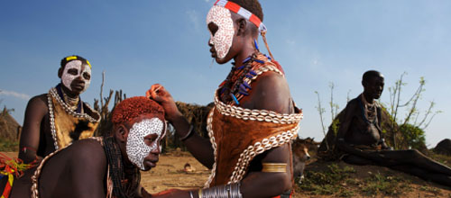
Omo Tribes
-
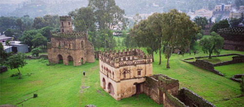
Gondar Castles
-
Debre Libanos
105km North of Addis Ababa, 13th Century Monastry
-
Langano
Popular resort for visitors, perfect for summing and water skiing
-
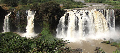
Nile Fall
-
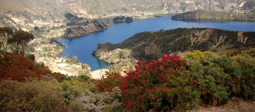
Wonchi
125km west of Addis Ababa, home of the popular Ambo meneral water. Wonchi-creator lake with number of bird species and Godar falls
-
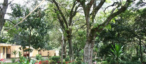
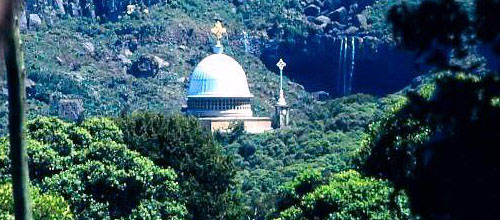
Wondo Genet
Popular hot spring resort
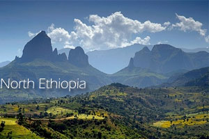
-Semien Mountains National Parks -Tigray Rock Hewn Churches -Denakil Depression -Trekking Siemen Mountains National Park
North
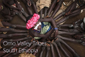
-Tour program of South Ethiopia at -South Omo Valley Cultural and Tribal Safari -Rift Valley Lakes -Fish Market -Wondo Genet natural hot spring
South
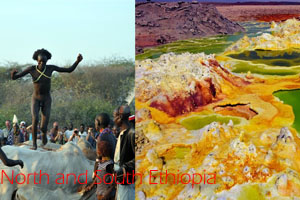
-North and South Ethiopia of -Omo Valley -Siemen Mountains and South Omo Valleys -South Omo Valley (Tribes and Market Days) -Danakil Depression
North South
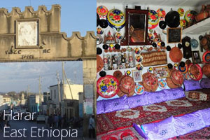
OmoValley tribal safari, Northern Historical sites, the Semien & Bale Mountains, Danakil Depression and Harar
North+ South+ East+ West
Wondo Genet (also transliterated Wendo Genet) is a resort town in Ethiopia. Located southeast of Shashemene in the Sidama Zone of the Southern Nations, Nationalities and Peoples' Region, with a latitude and longitude of 7°1′N 38°35′E and an elevation of 1723 meters.
Wondo Genet is connected to Shashamene by way of Wendo Wosha, by newly improved paved road; the last three kilometers from Wendo Wosha is a gravel road but in fairly good condition.
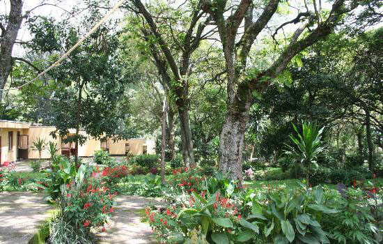
Wondo Genet is known for its hot springs and is surrounded by primary Ethiopian forests. It is home to an arboretum and a College of Forestry which was founded in 1977 with Swedish assistance. Also located in this resort town is the Essential Oils Research Sub Center, where spices, aromatic and medicinal plants are conserved and their qualities researched.
History
The Wondo Genet hotel was established in 1964, on land used as recreation site for the royal family until 1975. Emperor Haile Selassie bequeathed its name, meaning "Wondo Paradise", in reference to the beautiful panorama with a rich endowment of forests, wildlife and abundant water. Title to the hotel was transferred to the then Hotels Corporation, and currently it is a subsidiary of the Wabe Shebelle Hotels Enterprise. The hotel facilities include 54.4 ha area of land and possesses 40 bed rooms, restaurant and a bar, as well as swimming pools and access to the hot springs.
The Wendo Genet earthquake of 1983 was among the most significant in Ethiopia in the 20th century. Its magnitude has not been determined, but was severe enough that the frightened inhabitants gathered at the Ethiopian Orthodox church below the hotel to sing and pray the whole day and the whole night. A later disaster was a complex of forest fires which erupted in 17 places in southern Ethiopia on 10 February 2000 including the vicinity of the College.
Awasa (also spelled Awassa or Hawassa) is a city in Ethiopia, on the shores of Lake Awasa in the Great Rift Valley. It is located 270 km south of Addis Ababa via Debre Zeit, 130 km east of Sodo, and 75 km north of Dilla. The town serves as the capital of the Southern Nations, Nationalities, and Peoples Region, and is a special zone of this region. It lies on the Trans-African Highway 4 Cairo-Cape Town, and has a latitude and longitude of 7°3′N 38°28′ECoordinates: 7°3′N 38°28′E and an elevation of 1708 meters.
Awassa was capital of the former Sidamo Province from about 1978 until the province was abolished with the adoption of the 1995 Constitution. This city is home to Hawassa University (which includes an Agricultural College, a Main Campus and a Health Sciences College), Awasa Adventist College, and a major market. The city is served by Awasa Airport (ICAO code HALA, IATA AWA), opened in 1988. Postal service is provided by a main branch; electricity and telephone service are also available.[1] Important local attractions include the St. Gabriel Church and the Awassa Kenema Stadium. Fishing is a major local industry.
History
Church St. Gabriel
In September 1994 alone, 194 members of the Sidama Liberation Movement (commonly known as SLM1 to distinguish it from the pro-government SLM2) were arrested and held in Awasa prison. The chairman of SLM1, Woldeamanuel Dubale, had fled to the United Kingdom after an unsuccessful attempt in 1992 to assassinate him.
Sport
Football (soccer) and swimming are the most played games in Awassa, but recently basketball is also becoming popular among the youth. Biking and running competitions are also rarely held on the main streets of the town.
Education
Hawassa University, established in 1999 through the merger of a number of higher education institutions, is based in the city. Africa Beza College campus is in the city.
Abijatta-Shalla National Park is one of the National Parks of Ethiopia. Located in the Oromia Region 200 kilometers south of Addis Ababa to the east of the Ziway–Shashamane highway, it contains 887 square kilometers including the Rift Valley lakes of Abijatta and Shalla. The two lakes are separated by three kilometers of hilly land. The altitude of the park ranges from 1540 to 2075 meters, the highest peak being Mount Fike, which is situated between the two lakes.
Besides the two lakes, the primary attraction of this national park are a number of hot springs on the northeast corner of Lake Abijatta, and large numbers of flamingoes on the lake. Care must be exercised in driving vehicles out to the edge of this lake, as the thin crust of dried mud on the surface can give way without warning.
History
Although its intent was to protect wildlife, few wild animals currently can be viewed there. During the tumultuous period of the last days of the Derg regime, and for some time afterwards, large numbers of nomads took advantage of weakened central authority to move into the Park and set up residence with their livestock. Much of the Acacia woodland surrounding Lake Abijatta has been cut down for charcoal. Currently, not only do small groups continue to fell Acacia trees, but they go as far as to remove the salty soil from the lake shoreline and sell it.
A recent visitor noted that while viable breeding populations of greater kudu, Giant Striped Gnu, Grant's gazelle, black-backed jackal and spotted hyena may exist, he saw no evidence of their presence. Although baboons are still quite common, they were outnumbered by the livestock introduced by cattle herders. A few Grant's gazelle and several ostriches were kept in a fenced enclosure near the gate house. Nevertheless more than 300 bird species have been recorded in Abijatta-Shalla or the remnants of the adjacent park-like woodland. Reportedly, rehabilitation of this National Park had begun in 1996, and plans for active integration of local communities in its future planning and development had been announced.
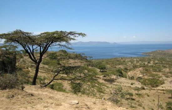
Langano (Amharic: ላንጋኖ) is a lake in the Oromia Region of Ethiopia, exactly 200 kilometers by road south of the capital, Addis Ababa, on the border between the Misraq Shewa and Arsi Zones. The first European to record its existence, Oscar Neumann, records that it was also known as "Lake Kore".[1] It is located to the east of Lake Abijatta in the Main Ethiopian Rift at an elevation of 1,585 meters.
Overview
Sunrise over Lake Langano.
According to figures published by the Central Statistical Agency, Lake Langano is 18 kilometers long and 16 km wide, with a surface area of 230 square kilometers and a maximum depth of 46 meters. The lake has a catchment 1600 square kilometers in size, and is drained by the Hora Kallo river which empties into the adjacent Lake Abijatta.
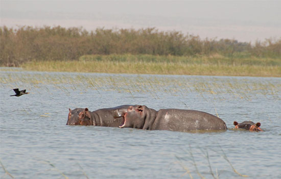
As it is free of Bilharzia (schistosomiasis), unlike all other freshwater lakes in Ethiopia, Lake Langano is popular with tourists and city-dwellers. The lake is brown in color. There are a number of resorts around the lake and water sports are popular. There is a variety of wildlife around the lake, which include hippos (rare), monkeys, baboons, warthogs, and a huge variety of birds. The area around the lake is largely deforested, however, and a large number of herders live around the area.
Two earthquakes had their epicenter near this lake, the first in 1906 (a magnitude 6.8 on the Richter scale), and the second in 1985 (magnitude 6.2). After the earthquake of 1906 there formed a 25 – 30 m tall geyser on Edo Laki Island on the northern part of the lake. The geyser disappeared circa 1966 - 1970, leaving a hot spring.
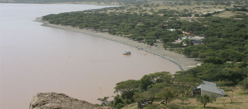
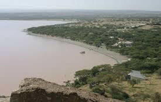
Lake Zway or Lake Ziway is one of the freshwater Rift Valley lakes of Ethiopia. It is located about 60 miles south of Addis Ababa, on the border between the Regions (or kililoch) of Oromia and of the Southern Nations, Nationalities, and Peoples; the woredas holding the lake's shoreline areAdami Tullu and Jido Kombolcha, Dugda Bora, and Ziway Dugda. The town of Ziway lies on the lake's western shore. The lake is fed primarily by two rivers, the Meki from the west and the Katar from the east, and is drained by the Bulbar which empties into Lake Abijatta. The lake's catchment has an area of 7025 square kilometers.
Lake Zway is 31 kilometers long and 20 km wide, with a surface area of 440 square kilometers. It has a maximum depth of 9 meters and is at an elevation of 1,636 meters. According to the Statistical Abstract of Ethiopia for 1967/68, Lake Zway is 25 kilometers long and 20 km wide, with a surface area of 434 square kilometers. It has a maximum depth of 4 meters and is at an elevation of 1,846 meters. It contains five islands, including Debre Sina, Galila, Bird Island and Tulu Gudo, which is home to a monastery said to have housed the Ark of the Covenant around the ninth century. The early 20th-century explorer Herbert Weld Blundell describes finding that "two distinct terraces of former shores rise some 80 feet above the present level, forming a ring round that nearest to the lake on the north, about 4 miles from the shore, marking a former basin." The northern shores were covered by papyrus. Weld Blundell includes in his account "a curious tradition, perhaps suggested by the apparent elevated shore," that the lake "was a kingdom 50 miles across, inhabited by seventy-eight chiefs" which disappeared in a single night.
The lake is known for its population of birds and hippopotamuses. Lake Zway supports a fishing industry; according to the Ethiopian Department of Fisheries and Aquaculture, 2,454 tonnes of fish are landed each year, which the department estimates is 83% of its sustainable amount.
The shores and islands of Lake Zway are the home of the Zay people. Tradition states that when the Muslim Ahmad ibn Ibrihim al-Ghazi conquered Ethiopia, the Christians of the area took refuge on its islands. They were later isolated from the rest of Ethiopia by the Oromo people, who settled around the lake. At the time Menelik II conquered the lands around the lake, the lake-dwellers were rediscovered and found to have preserved both their Christian faith and a number of ancient manuscripts.
Who is Online
We have 183 guests and no members online
© 2025 Alpha Tour & Travel